Urban vulnerability to climate change
Map book of Climate-ADAPT
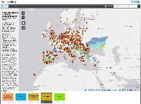
The European Environment Agency (EEA) published today a series of interactive maps, illustrating various climate threats European cities face as well as cities’ capacity to respond to these threats. This new ‘map book’ provides background information and allows users to view the maps, selecting different parameters.

There are four climate threats clusters: heatwaves, drought and water scarcity, flooding and forest fires. The map book on the European Climate Adaptation portal Climate-ADAPT shows how different factors, such as the amount of green urban areas, the share of elderly people or levels of trust and financial resources, interact at city level.
The map book provides a first indication of cities’ vulnerability and can be supplemented with more detailed local data. The section ‘Explore further’ guides users to create their own web maps by adding supplementary data. The section also provides links to other information sources and tools. These include the recently developed time series tool (developed by the JRC Institute for Environment and Sustainability), which shows the past development and future projections of different climate variables such as temperature, rainfall or solar radiation.
Urban vulnerability to climate change in Europe – a map book (Pilot version) [1]
